Pinhook Swamp Boundary Survey – Lord Parcel
Market Supported
Boundary Survey, Legal Description Preparation, Title Review, GIS Integration
Location
Columbia County, Florida
Client
Florida Department of Environmental Protection
Time Frame
January 2025 through March 2025

Scope
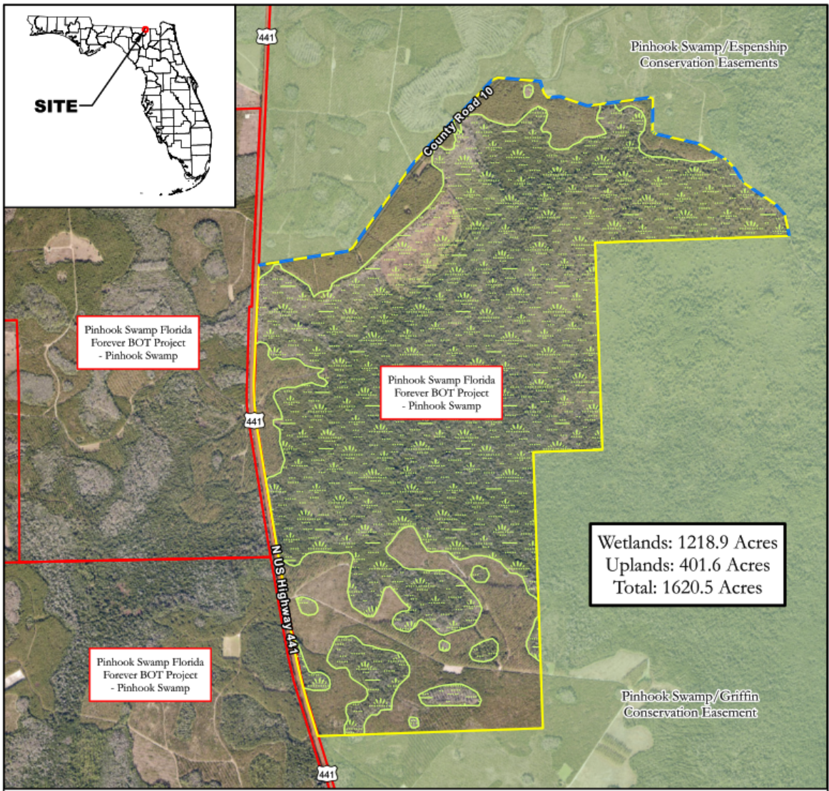
Degrove Surveyors was selected by the Florida Department of Environmental Protection’s Division of State Lands to perform a comprehensive boundary survey and legal description of the Lord Parcel, a 1,620.46-acre tract within the Pinhook Swamp Florida Forever Project area in Columbia County, Florida. The property adjoins state-managed conservation lands and serves as a critical ecological connection between the Osceola National Forest and the Okefenokee Swamp ecosystem
Main Project Tasks
Key Project Components
Degrove completed a comprehensive boundary retracement of the Lord Property, this included recovery and verification of all controlling corners and monuments across Sections 13, 23, 24, 25, 26, 35 & 36, Township 2 North, Range 16 East, and Sections 19 & 30, Township 2 North, Range 17 East. The identification and documentation of title easements, hunting rights, and encumbrances based on the Title Commitment supplied to Degrove , ensured legal clarity for state acquisition.
Degrove completed the field location and mapping of all visible improvements, fences, and access routes connecting the property to U.S. Highway 441 (State Road 47). This included the recovery of monuments along the U.S. 441 corridor to validate boundary alignment and historical survey ties.